Westerville Printable Map Handout
Ohio to Erie Trail Office | Published on 3/4/2024
WESTERVILLE NAVIGATION TOOLS
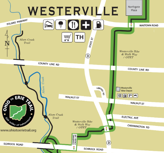
To help people navigate the Westerville route between the Alum Creek Trail and the trail continuation at Hanby park, we have created a special at a glance document. The green line is the official Ohio to Erie Trail route through Westerville.
NEW RESOURCE: DOWNLOAD THE 2 PAGE MAP OVERVIEW
Westerville Handout
Westerville Parks and Recreation Maps
Westerville Maps
Westerville Parks and Recreation offers many locations for families to enjoy the trails, playgrounds or even rent a shelter for a celebration. Click the interactive digital map to explore Westerville parks and trails. To download a printable map, click here.